
New Hope ZIP Coverage
New Hope commonly uses 55427 and 55428. They are practical starting points for a ZIP lookup, not city-limit lines. The postal-locality reference inspected for this research names Minneapolis as the preferred locality for both ZIPs and lists New Hope among acceptable locality labels. The city resident guide supplies post-office service context. Preserve a returned postal label even when a county map confirms that the parcel sits in New Hope.
| ZIP Code | Areas Covered | Post Office | Notes |
|---|---|---|---|
| 55427 | New Hope addresses using a shared postal ZIP; acceptable labels include Crystal, Golden Valley, and New Hope. | Golden Valley Post Office listed in the city guide. | Preferred locality in the inspected reference: Minneapolis. |
| 55428 | New Hope addresses using a shared postal ZIP; acceptable labels include Brooklyn Center, Brooklyn Park, Crystal, and New Hope. | Crystal Post Office, with Brooklyn Center also in the guide’s service grouping. | Preferred locality in the inspected reference: Minneapolis. |
| 55442 | Not a New Hope ZIP in the inspected sources. | Plymouth/Lost Lake appears as a separate nearby service area. | Do not fold this ZIP into New Hope results. |
A preferred label is a postal convention. An acceptable label is also not an annexation record. ZIP research notes should capture the queried address, returned ZIP, preferred locality, acceptable locality list, and date checked so a Minneapolis or nearby-city result is understood as a delivery result rather than treated as an error.
Note: A ZIP lookup provides mailing normalization, not proof that a person or organization is connected to the returned address.
Read New Hope ZIP Localities
The USPS-derived ZIP and city reference lists Minneapolis as preferred for 55427 and 55428, while also listing the neighboring acceptable localities. That mix is expected in this part of Hennepin County. New Hope’s eastern edge with Crystal is irregular, and the city’s history records annexation pockets. A postal response that says Crystal, Golden Valley, Brooklyn Center, or Brooklyn Park does not by itself move a parcel out of New Hope.
New Hope is about 5.1 square miles. The city’s Metropolitan Council profile reports a 2024 population of 21,545 and 9,021 households, which provides city-scale context without turning ZIP boundaries into municipal geography.
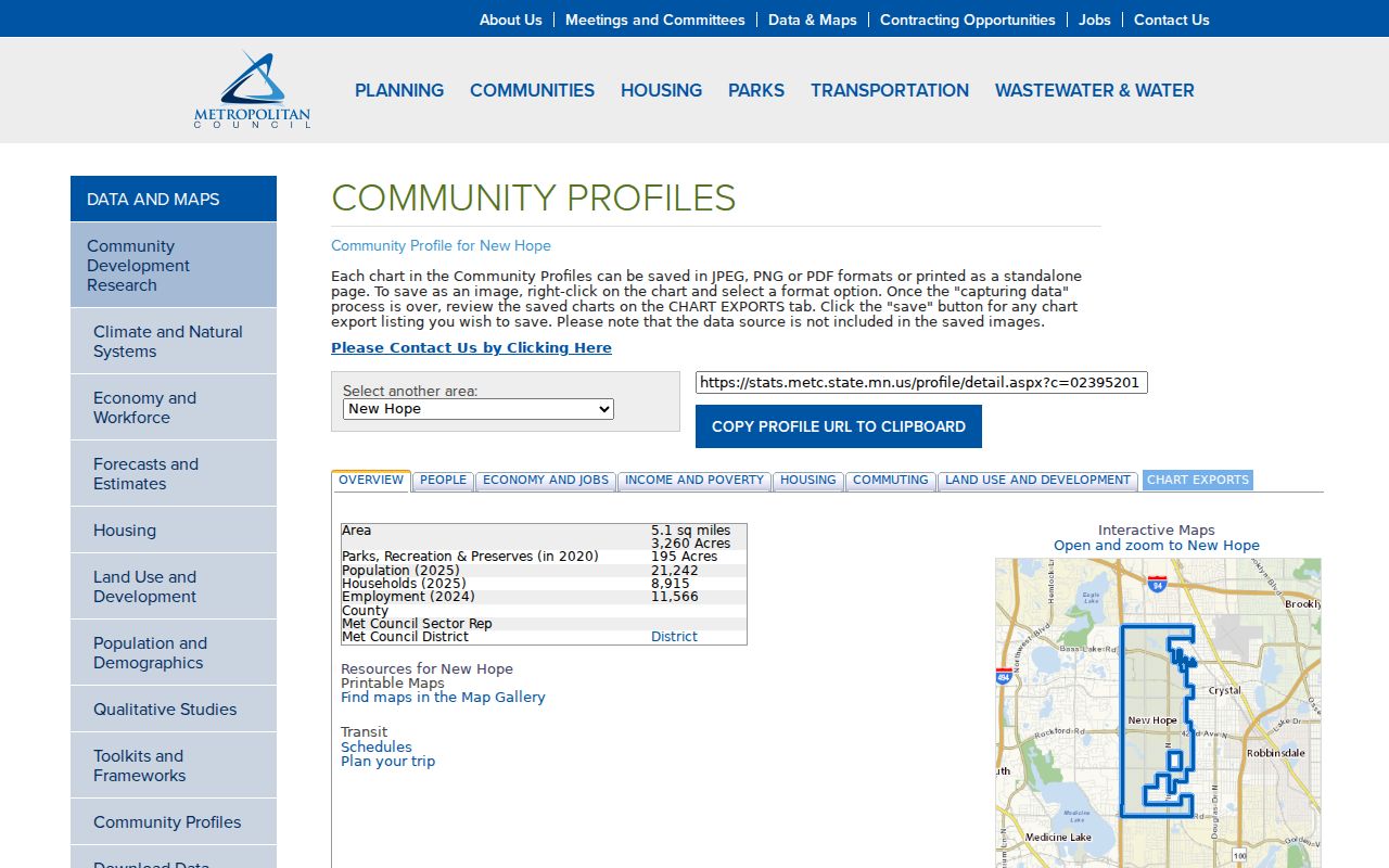
The profile identifies the municipality, while the postal result and parcel map answer separate address questions.
Postal label versus city line. Retain both labels when they differ. Use the Hennepin parcel record and city map to evaluate municipal location, not the preferred USPS locality alone.
Use New Hope Postal Fields
The USPS ZIP Lookup has three different search modes. Address mode tests a delivery address. City-and-state mode returns ZIP choices for a locality. ZIP-to-cities mode returns locality choices for a five-digit ZIP. Each is useful at a different point in a New Hope postal search, and none substitutes for a county parcel result.
| USPS mode or field | Input type | Requirement shown | How to use it |
|---|---|---|---|
| Street, city, state | Text and selection | Required in address mode | Normalize a specific New Hope delivery address. |
| Apt or suite | Text | Optional | Add only when it is part of the delivery address. |
| Company, urbanization, ZIP | Text | Optional by mode | Supporting inputs, not substitutes for the core address. |
| City and state | Text and selection | Required in city/state mode | Find postal ZIP choices for a named locality. |
| Five-digit ZIP | Text | Required in ZIP-to-cities mode | Review associated locality choices. |
Save the exact returned string. The research record for a difficult address should also note the municipal interpretation from the city or county map, the ZIP, and the search date. That four-part note explains most apparent locality conflicts without overwriting a historical or postal label.
Match New Hope ZIPs to Parcels
Hennepin’s parcel methodology includes city and ZIP attributes, but the live Hennepin County Property Information Search advertises address, PID, addition name, and interactive-map paths instead of a ZIP-only search. That is not a missing feature. The parcel system is designed to identify a particular parcel after a postal result has normalized the address. Use the result to obtain the 13-digit PID, then check the parcel map and legal description.
The working sequence is USPS address result, accepted city label, Hennepin parcel address and PID, New Hope map or city boundary, then any tax mailing address. The last field is a tax-contact field and can differ from the parcel location. Hennepin’s Property Interactive Map is the online next step, while county Property Information lists telephone, email, counter, and service-request routes when a dynamic search does not resolve the record.
For the street-level record chain after the parcel is identified, the New Hope Street Directory follows the PID into maps, permits, and recorded instruments.
Find New Hope Records by ZIP
A ZIP search should narrow a record question rather than attempt to create a neighborhood roster. USPS resolves delivery formatting. MNVotes accepts ZIP as one route in an individual registration match. Hennepin parcel records then connect a known address to a PID. Minnesota Unclaimed Property can accept a city and ZIP as a recovery-search filter, but it is not evidence of a current address.
- Run the known address through USPS and record the returned ZIP, preferred locality, and acceptable labels.
- Use the normalized address, not ZIP alone, in Hennepin Property Information or the county parcel map and save the PID.
- When verifying an individual registration match, use Minnesota Secretary of State MNVotes with its required first name, last name, birth-date input, and either ZIP mode or Hennepin, New Hope, house-number, and street fields.
- Use Minnesota Unclaimed Property only as a name-and-ZIP recovery lead. Keep its result separate from residence, parcel, and postal evidence.
- Record source date and role beside every result. A voter response is a registration match workflow, while a parcel response is a land record.
MNVotes updates nightly, and an application can take up to 14 days. Exact birth date is required to match but is not shown publicly. A public voter list has separate requester, request, payment, and classification conditions under Minnesota law, so it is not the same as a ZIP-wide web search.
Note: Do not treat an unclaimed-property listing, voter match, or postal ZIP result as current-occupancy proof.
New Hope ZIP 55427
The New Hope Residents Guide lists the Golden Valley Post Office, 7701 Golden Valley Road, Golden Valley, MN 55427, phone 763-544-4126, for the 55427 service information. The guide is a local reference point. USPS should be checked for a current delivery result or post-office detail before relying on it for a live mailing task.
The accepted-locality reference pairs 55427 with Minneapolis as preferred and Crystal, Golden Valley, and New Hope as acceptable. A ZIP directory entry for a 55427 address should therefore preserve the postal return and compare it with the New Hope parcel and city-map result.
New Hope ZIP 55428
The same Residents Guide lists the Crystal Post Office at 5550 West Broadway Avenue, Minneapolis, MN 55428-3551, phone 763-536-0493, and includes Brooklyn Center Post Office in the 55428 service grouping. It gives the Brooklyn Center location as 6848 Lee Avenue North. These guide entries should remain labeled as guide information, with current USPS service details verified when needed.
For 55428, the inspected postal-locality reference uses Minneapolis as preferred and names Brooklyn Center, Brooklyn Park, Crystal, and New Hope as acceptable. The range of labels makes the parcel and municipal map check essential, especially near the irregular eastern boundary.
New Hope ZIP Geography Over Time
Postal and municipal geography can change on different schedules. Before New Hope incorporated in 1953, early land and address material may use Crystal Lake Township, Crystal, a rural route, or a post-office locality. Incorporation did not instantly standardize every deed, directory, tax roll, or newspaper label. Keep an older source label as written and use current parcel mapping only to test the modern location.
Historic ZIP and post-office research needs an official historical route rather than a present-day lookup alone. The USPS historic post-office-by-ZIP resource is the documented starting point. No New Hope-specific historical change table was located in the inspected sources, so a historical ZIP claim should remain scoped to the source and date actually found.
New Hope ZIP Boundaries and Terms
ZIP code boundaries and New Hope city limits are separate systems. A ZIP is designed for mail delivery. A city boundary is a municipal and legal geography. When those systems disagree, preserve both labels, use the parcel/PID result for the land record, and use a survey or legal description when a legal boundary matters.
- ZIP versus ZIP+4
- A five-digit ZIP identifies a broad delivery area; ZIP+4 adds a more specific delivery segment and does not redefine the municipal boundary.
- PO box ZIP
- A ZIP used for post-office boxes rather than a broad set of street-delivery addresses.
- Unique ZIP
- A ZIP assigned to one organization or delivery purpose. No such New Hope ZIP was established in the inspected sources.
- Carrier route
- A postal delivery grouping within a ZIP. It is a delivery tool, not a resident or property boundary.
Limits also apply to the linked records. The assessor does not advertise a ZIP-only public search. USPS cannot prove who is at an address. MNVotes does not display exact birth date, and Safe at Home can suppress a participant’s real address. A result should always identify its custodian, field type, and date.
Use records carefully. Do not use ZIP, parcel, or voter information to expose a protected address, stalk, harass, or intimidate another person.